Langisjór Lake
Langisjór Lake
Nestled between the Vatnajökull glacier and Landmannalaugar, Langisjór Lake is one of Iceland's best-kept secrets in the Highlands. Access, hiking trails, and expert advice.
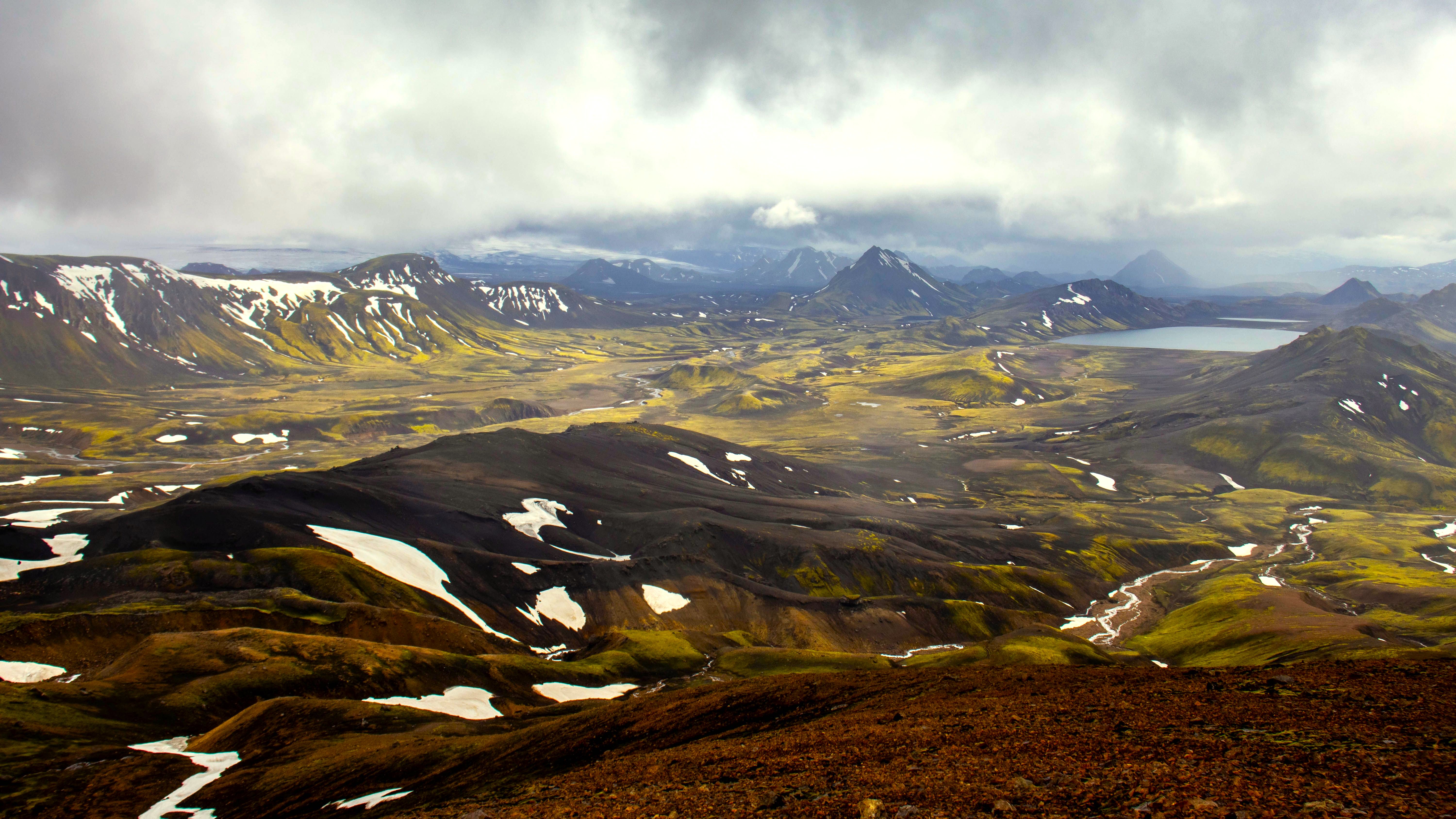
Langisjór Lake mirrors the route (F235) that leads to it—utterly picturesque. It is the precious gem of Iceland's Highlands, lost at the edge of a vast expanse of black sand between the majestic Vatnajökull glacier to the north and Landmannalaugar. If you're ready to venture beyond civilization and the well-trodden tourist circuits to witness a site of rare beauty, Langisjór will reward you generously.
History
Many mysteries still surround Langisjór, one of Iceland's largest lakes (excluding artificial reservoirs). Long concealed within the highlands, the site remained secret until the 19th century, when in 1878, farmers searching for lost sheep stumbled upon it.
Where Does the Name Langisjór Come From?
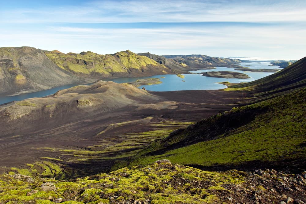
The lake's name means "The long sea," referring to its elongated form stretching 20 km in length and just 2 km in width. Langisjór nestles between two major mountain ranges: Tungnaárfjöll and Fögrufjöll. At the end of the 19th century, Þorvaldur Thoroddsen, Iceland's first geologist, visited the region. He named the mountain from which he observed the lake Mount Sveinstindur, as a tribute to his physician friend.
Discovering Langisjór
Langisjór ranks among the lesser-visited yet highly recommended attractions in the highlands. It sits within a landscape of volcanic ash deserts and verdant mountains. Its crystalline waters originate from neighboring glaciers and feed smaller lakes scattered throughout the region.
What Does Langisjór Lake Look Like?
Langisjór begins just kilometers from the Tungnaárjökull glacier, southeast of the Vatnajökull ice cap, and stretches lengthwise between the ranges of Fögrufjöll (1,090 m) and Tungnaárfjöll (1,018 m). The lake itself sits at 670 m elevation; it covers an area of 27 km² with a depth of 75 m.
What to See at Langisjór Lake?
You access the beginning of Langisjór via the F235 track. Not far away, you'll find a cabin belonging to the Vatnajökull National Park, behind which sits a small observation platform. From this vantage point, you can admire the lake's striking azure hue meeting the Vatnajökull glacier. Surrounding it, the black tones at the mountain base and green hues on the peaks create a deeply moving contrast. Natural scenes shift with the weather, yet they never disappoint.
For the most adventurous explorers, a steep and challenging trail—mostly snow-covered—leads to the Sveinstindur summit. The view of Langisjór Lake from these heights, at roughly 1,000 m altitude, reveals one of Iceland's most spectacular landscapes. Additional enchanting viewpoints exist on the left shore in the direction of Tungnaárjökull mountain.
To reach Langisjór Lake, you must first take the F208 route. Upon reaching the section between Eldgjá volcano and Landmannalaugar, turn onto the F235. The track extends approximately 23 km, then becomes sandy with several river crossings, continuing for about twenty kilometers to Langisjór.
Essential Information About F235
The F235 winds through a vast black sand desert and green mountains. River crossings are numerous along the route but remain manageable. After about 10 km, a right fork leads to Blautulon Lake. You can traverse the lake by following its left shore to reach the Uxatindar mountain, which is moss-covered.
In the western section of the Vatnajökull National Park, all roads are mountain tracks. Only 4x4 vehicles, ideally super-jeeps, are capable of navigating them. Rocky passages and potholes are scattered throughout. Gravel is omnipresent. You'll occasionally need to cross glacial streams and rivers, presenting a genuine challenge for the unprepared.
No regular public transport currently serves the region. The nearest stops are at Landmannalaugar and Kirkjubæjarklaustur.
Accessibility
The Langisjór Lake region welcomes adventurers year-round. However, road accessibility depends greatly on weather conditions. Generally speaking, tracks are passable from June through early autumn, around mid-September. Only routes marked on accompanying maps—obtainable from designated services—are permitted. Other paths, including off-road shortcuts, are prohibited for the general public.
During summer, rangers from Vatnajökull National Park are stationed throughout the area to provide essential information about local attractions, trails to follow, and weather forecasts. Rangers patrol the roads and tracks from the start of the season in June until their departure in September.
Want to discover this destination?
Our local advisors design your tailor-made trip.