West Fjords
Iceland's most ancient peninsula, accessible June through September, requiring a minimum of 5 days to explore its fjords, puffin cliffs, and remote geothermal baths.
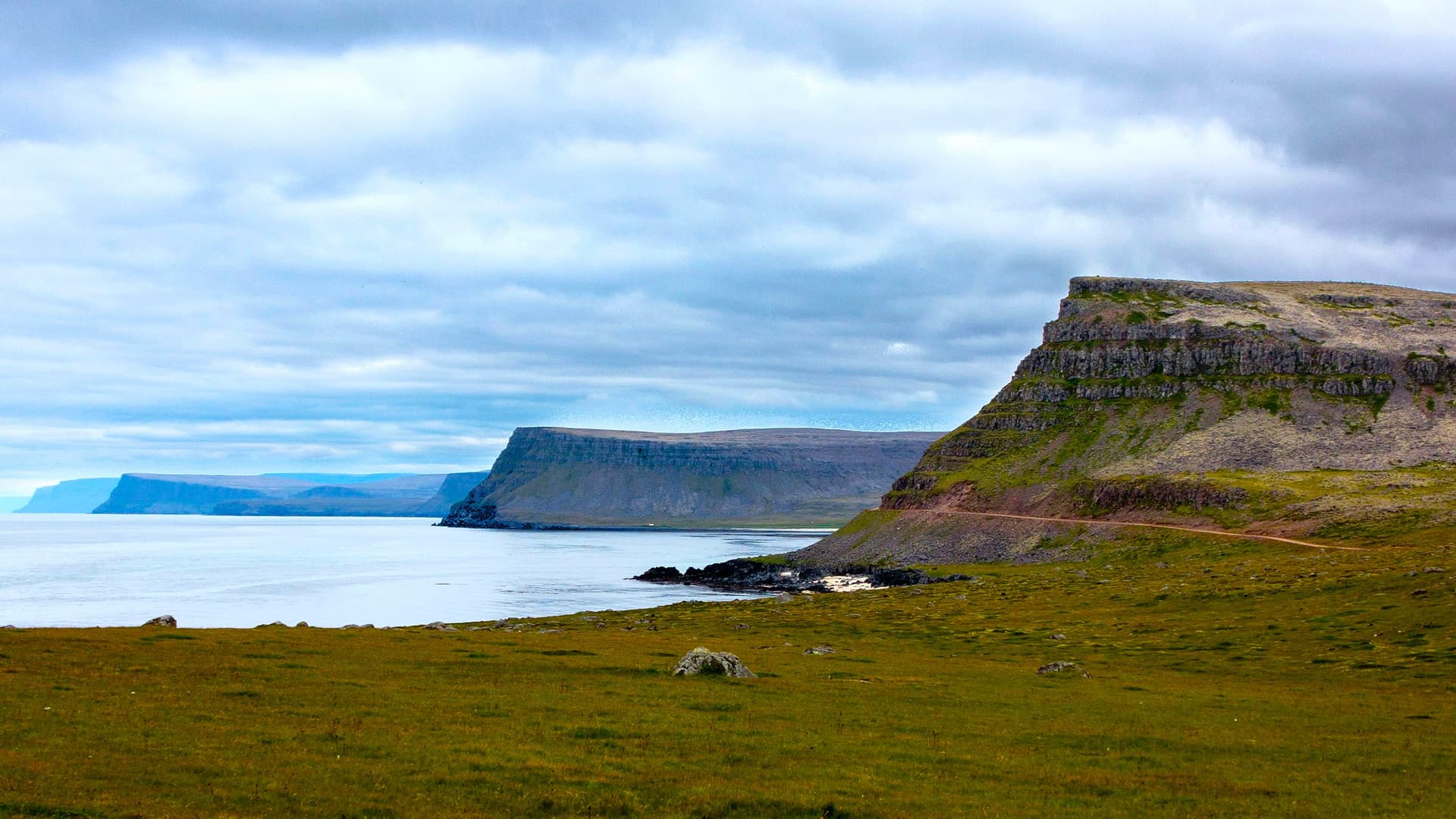
The Vestfirðir, or West Fjords, form a peninsula connected to the rest of Iceland by a seven-kilometre isthmus. Geologically, it is the oldest part of the country, dating back approximately 16 million years, which explains the deeply carved terrain: a succession of profound fjords sculpted by glaciers, separated by basalt plateaus rising between 500 and 900 metres. Route 60, known as Vestfjarðavegur, hugs the coast for nearly 950 kilometres around the entire perimeter, with a portion still unpaved gravel road in the south between Bíldudalur and Þingeyri.
Ísafjörður, home to 2,600 inhabitants, is the sole proper town and our logistical reference point. It offers a small airport connected to Reykjavik by domestic flight (40 minutes), a port where boats depart for the Hornstrandir reserve, and the peninsula's rare supermarkets. The other settlements—Patreksfjörður to the south, Hólmavík to the east, Suðureyri and Flateyri along the northern coast—each count a few hundred residents who live from cod and shrimp fishing, along with modest summer tourism.
The region's raw character stems from several cumulative factors. First, the weather: the fjords trap cloud masses and receive more precipitation than the south, with tidal ranges among Iceland's strongest. Second, the isolation: no major glaciers, no active volcanoes, but sea cliffs plunging sheer 400 to 500 metres, as at Látrabjarg, the most westerly point of continental Europe outside archipelagos. Finally, a population density of 1.2 inhabitants per square kilometre, against an already modest national average of 3.5.
Local culture retains an imprint that has vanished elsewhere on the island. At Hólmavík, the Museum of Icelandic Witchcraft documents seventeenth-century witch trials, particularly numerous in this region where twenty men were burned between 1654 and 1690. At Bíldudalur, a small museum is dedicated to the sea monsters of Arnarfjörður fjord, which hold genuine significance in oral traditions through the early twentieth century. Hákarl, fermented shark typically tasted in winter, and harðfiskur, wind-dried fish, remain everyday products here rather than tourist curiosities.
In terms of landscape, Dynjandi waterfall remains the most iconic landmark: a 100-metre cascade in fan formation, 30 metres wide at the crest and 60 metres at the base, preceded by six smaller cascades on the same river. Further south, Rauðisandur beach stretches its 10 kilometres of orange-red sand, formed from crushed shells, at low tide. On the northern coast, the natural geothermal baths of Reykjafjarðarlaug and Krossneslaug lie along the shore, several hours' drive from any services. The Hornstrandir reserve, abandoned by its last inhabitants in 1952, is reached only by boat from Ísafjörður and traversed on foot with backpack along unmarked trails.
Economically, the peninsula still depends largely on the sea. Suðureyri operates a day-by-day traceable fishing model, and visitors can, by arrangement, observe boat returns at dawn and visit the processing line. This type of direct access, more than sites ticked off a map, characterises travel in the Vestfirðir.
Must-See
Dynjandi fan-shaped waterfall. A main cascade of 100 metres preceded by six modest falls on the same river, accessible via a 15-minute trail from the Route 60 parking area. The roar (dynjandi means "the thunderous") is audible well before the first glimpse.
Látrabjarg cliffs in June–July. 14 kilometres of cliffs rising 400 to 440 metres, where puffins, guillemots, and gannets can be observed at close range. Puffins leave nests by mid-August, making the viewing window narrow.
Red beach of Rauðisandur. 10 kilometres of orange sand formed from crushed shells, accessible via a winding mountain track from Patreksfjörður. Colour varies from beige to deep red depending on light and tide.
Krossneslaug natural bath. Geothermal pool by a shingle beach on the Strandir coast, 75 kilometres north of Hólmavík via a track ending in a cul-de-sac. Water at 38°C facing the Arctic Ocean.
Hornstrandir reserve. Peninsula abandoned in 1952, roadless and unpopulated, reached by boat from Ísafjörður from late June to mid-August. Self-sufficient treks of 3 to 6 days to observe Arctic foxes that have grown unafraid.
When to Visit
The practical window runs from mid-June through early September. In July, daytime temperatures on the coast range between 9 and 13°C, the sun does not truly set before month's end, and all secondary tracks (Route 612 towards Látrabjarg, Route 643 towards Krossneslaug, Route 622 towards Selárdalur) are open. June offers the best conditions for observing nesting birds at Látrabjarg and Hælavíkurbjarg, though some high-altitude roads are not cleared of snow until late month.
From October to May, most interior roads close and several passes (Hrafnseyrarheiði, Dynjandisheiði) become impassable without a four-wheel-drive equipped vehicle. Annual precipitation exceeds 2,000 mm on the southern slope, compared to 800 mm in Reykjavik, and fjords are snow-covered from November onward. We advise against the region in winter except for specific northern lights projects from Ísafjörður, reachable by domestic flight when Route 60 is cut. Boats to Hornstrandir operate only between approximately 15 June and 31 August.
Practical Advice
Allow a minimum of 3 days for an overview (Dynjandi, Látrabjarg, Rauðisandur on a southern loop), 5 days to include Ísafjörður and the northern Strandir coast, 7 days to add a 3-day trek at Hornstrandir. Distances appear short on a map but roads wind around each fjord: 40 kilometres as the crow flies often equals 120 kilometres of driving at an average 60 km/h. The simplest entry point remains the route from Borgarnes via the Hvalfjörður tunnel, around 4 hours 30 minutes from Reykjavik to Patreksfjörður. Ísafjörður airport is an alternative for travellers with limited time.
The most coherent combination is with Reykjavik and the Southwest at the start or end of your itinerary, or as a full loop with the North and Lake Mývatn via Route 1 through Hvammstangi. Coupling with the Highlands or the East Fjords in a single journey requires a minimum of 18 to 21 days in country. The region suits independent travellers, hikers, photographers, and lovers of quiet coastal landscapes. Comfort remains rustic: family guesthouses, farmhouse inns, two or three upper-category hotels in Ísafjörður and Patreksfjörður. Our team in Reykjavik reserves accommodation 6 to 9 months ahead for July, as supply is limited.