Mælifell Volcano
Mælifell Volcano
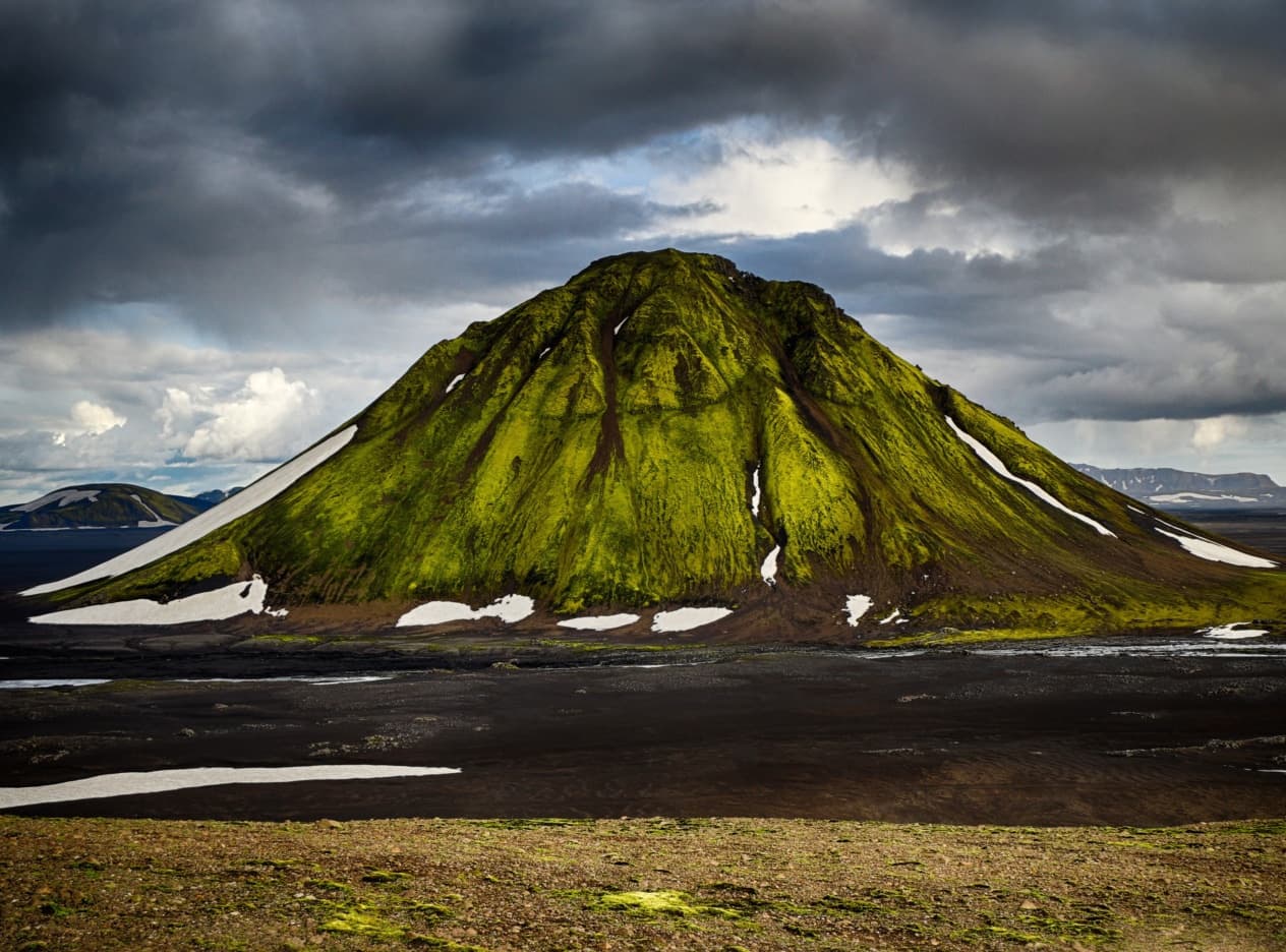
A moss-green cone planted in the black sand of Mælifellssandur, Mælifell is reached via the F-tracks of Iceland's Highlands, open from June to September.
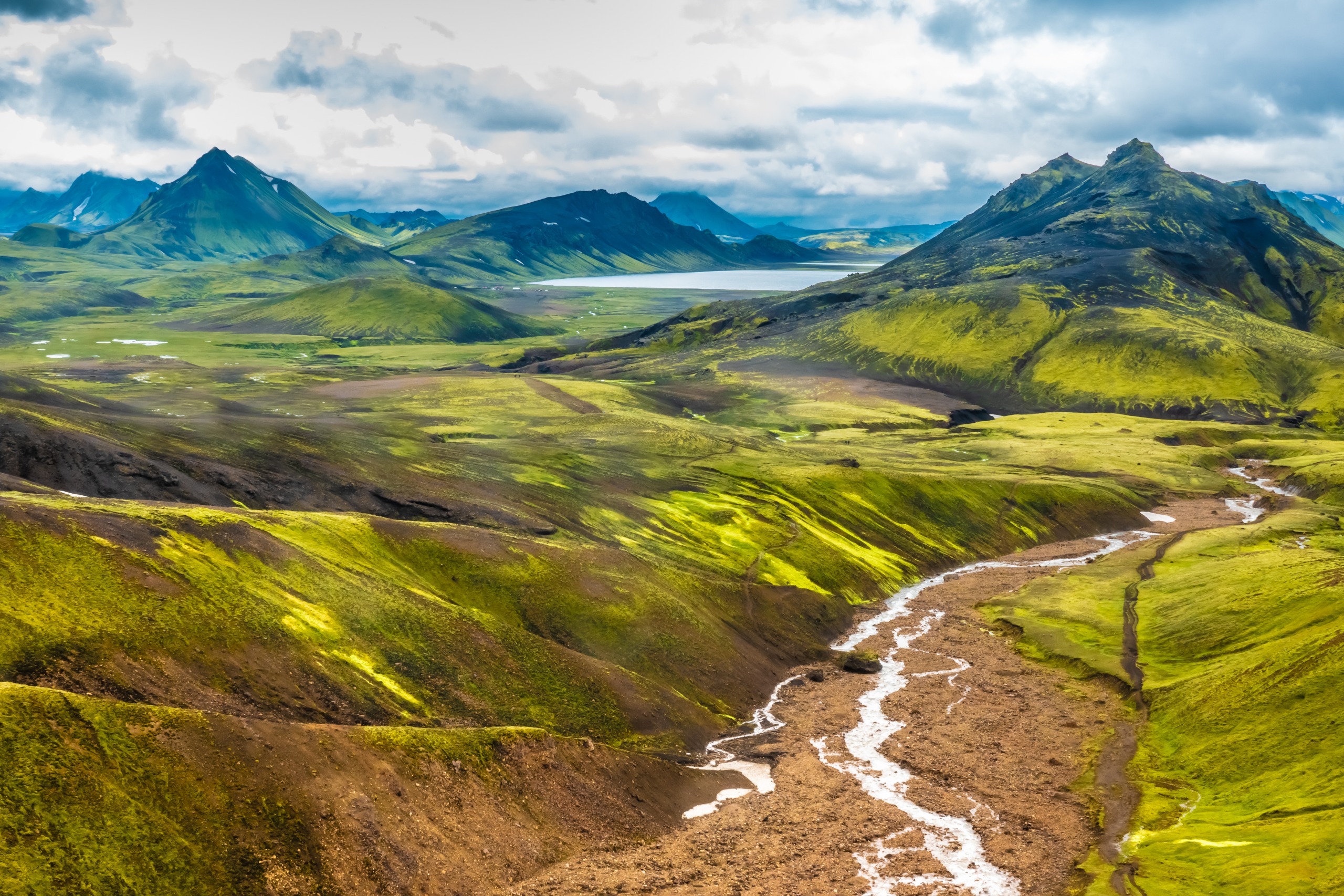
The Mælifell volcano stands at the heart of Iceland's Highlands, a moss-covered cone rising from the black sand desert of Mælifellssandur. Nicknamed the "Green Pyramid," it belongs to the Katla volcanic system and remains one of the most identifiable landmarks in the southern Highlands.
Why visit Mælifell
Mælifell offers a rare geological contrast: a regular cone blanketed in tender green moss in summer, set upon a plain of black ash from subglacial eruptions. The site combines volcanic interest, panoramas of the Myrdalsjökull ice cap, and access to some of the Highlands' most challenging routes. Several scenes from the Game of Thrones series were filmed here, contributing to its renown.
The volcano makes for a brief stop from a 4x4 track, but it also fits into longer itineraries heading toward Landmannalaugar or Þórsmörk.
History and geology
Mælifell emerged in southern Iceland when glaciers retreated following volcanic eruptions beneath the Myrdalsjökull ice cap, roughly 10,000 years ago, during the last glaciation. It is a composite cinder cone, rising approximately 200 m above the sand desert surrounding it, with an elevation close to 800 m.
Its name means "Measuring Hill." Several other Icelandic reliefs bear this place name: they served as navigation points for the first inhabitants to orient themselves in landscapes devoid of stable landmarks.
What to see on site
- The green cone: the moss covering it is visible only in summer and explains its Green Pyramid nickname.
- The Mælifellssandur: an expanse of sand and black ash that contrasts with the volcano and defines the site's visual character.
- Glacial rivers: fed by melt from Myrdalsjökull, they wind through the plain and structure the landscape.
- The Myrdalsjökull glacier: its foothills lie just a short walk south of the volcano.
- The summit: accessible on foot for equipped hikers, it offers the clearest view over the desert and ice cap.
Mælifell can be incorporated into the Laugavegur trail, which connects Landmannalaugar to Þórsmörk over several days.
How to get there
Access to Mælifell is exclusively via F-tracks, reserved for 4x4 vehicles. Water levels at river crossings vary considerably by season, precipitation, and time of day.
Via the F232 track (south)
This is the shortest and most accessible route. The starting point is on Route 1, between Kirkjubæjarklaustur and Vìk. River crossings here generally range from 20 to 40 cm. Good ground clearance is necessary to traverse stony sections. On the final segment before the junction with F210, black sand can become waterlogged in warm weather: it is advisable to cross early in the day. The track then joins F210 to the volcano.
Via F233 or F210 from the east
This access remains feasible but involves a challenging passage: the Holmsa ford, located on F210 approximately 1.5 km west of the F233 junction. Its depth can reach 55 cm, sometimes more depending on conditions.
Via F210 from the west
This is the most demanding route, reserved for experienced high-clearance 4x4 drivers. Between F261 and Route 264, there are roughly twenty river crossings. Two passages are particularly tricky: the Ljósá, where multiple channels can be waterlogged, and the Bratþálskvísl, just before the F261 branch. The section crosses the Fjallabak reserve.
Via F261
F261 skirts the Markarfljot gorges and can be combined with F210. It has only one notable ford, that of the Bratþálskvísl, with muddy water and marked current.
For any river crossing, assess the water level on foot before committing. If in doubt, wait for another vehicle or turn back.
When to go
Iceland's Highlands, and thus the Mælifell area, are accessible only between June and September. Outside this window, snow covers the tracks and the official opening of F-roads is suspended. July and August offer the best ford conditions, while green moss is at its peak in mid-summer.
Practical information
- Access: free, no admission fee or visitor facilities.
- Vehicle: 4x4 mandatory, ideally high-clearance for western routes.
- Fuel: no petrol stations in the Highlands; fill up before entering the zone.
- Equipment: waterproof clothing, boots for assessing river crossings, offline GPS.
- Safety: consult F-track opening bulletins and ford conditions before departing.
Nearby
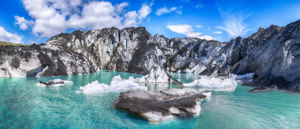
- The Myrdalsjökull ice cap: the glacier to which Mælifell owes its existence, a short walk south.
- Katla: the active volcano hidden beneath Myrdalsjökull, which structures the entire geological system of the region.
- Strútslaug hot springs: natural pool accessible from nearby tracks.
- Landmannahellir: refuge and camping zone, a logistical hub for exploring Fjallabak.
- Mount Hekla: one of the country's most active volcanoes, on the western edge of the Highlands.
FAQ
Frequently asked questions
Yes. All tracks leading to the volcano are F-tracks, closed to standard vehicles. For western routes, a high-clearance 4x4 is strongly recommended due to river depth.
June to September only. F-tracks are closed the rest of the year. The green moss that characterizes the cone is in full display in July and August.
The F232 track from Route 1 is the shortest and least exposed, with river crossings generally between 20 and 40 cm. It suits a cautious approach.
Yes, the ascent is on foot, without technical gear, but over soft terrain. Expect a short but steady walk from the base of the cone.
Yes, the volcano sits on variants of the Laugavegur trail between Landmannalaugar and Þórsmörk, and can fit into a multi-day itinerary in the Fjallabak reserve.
Planning your trip
Mælifell is part of a broader exploration of Iceland's Highlands, where each track imposes its own rules. To build a coherent itinerary combining volcanoes, glaciers, and hot springs, consult our Iceland journeys.
Nearby
Interested in this visit?
We can include it in your personalised itinerary.