Askja Volcano
Askja Volcano
Askja is a volcanic massif in Iceland's Highlands, accessible by 4x4 in summer. It is home to the deep lake Öskjuvatn and the geothermal crater Víti, where bathing is possible in the heart of a lava desert.
Askja is a volcanic massif in Iceland's Highlands, situated in the lava desert of Dyngjufjöll, at the heart of Vatnajökull National Park. It contains two calderas: one occupied by Lake Öskjuvatn, one of the deepest bodies of water in Iceland, and another by the geothermal lake Víti, whose milky, warm waters permit bathing. Accessible only in summer, Askja is raw volcanic terrain, far from any infrastructure.
Quick Facts
- Access: Route F88 (4x4 mandatory), typically open from late June to early October depending on snow conditions
- Recommended duration: plan a full day from Akureyri or Mývatn, including the round-trip hike to the calderas
- Bathing in Víti: permitted, but the descent to the lake is steep and slippery — hiking boots are essential
- Equipment: warm and waterproof clothing even in summer, frequent strong winds
- Supplies: no services on-site — bring sufficient water, food, and fuel
- Accessibility: not accessible, unimproved volcanic terrain
What to See
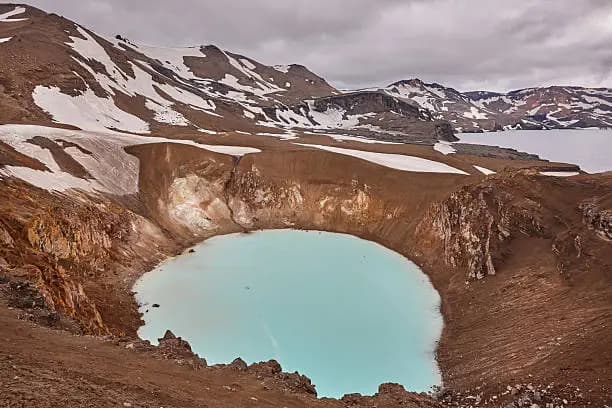
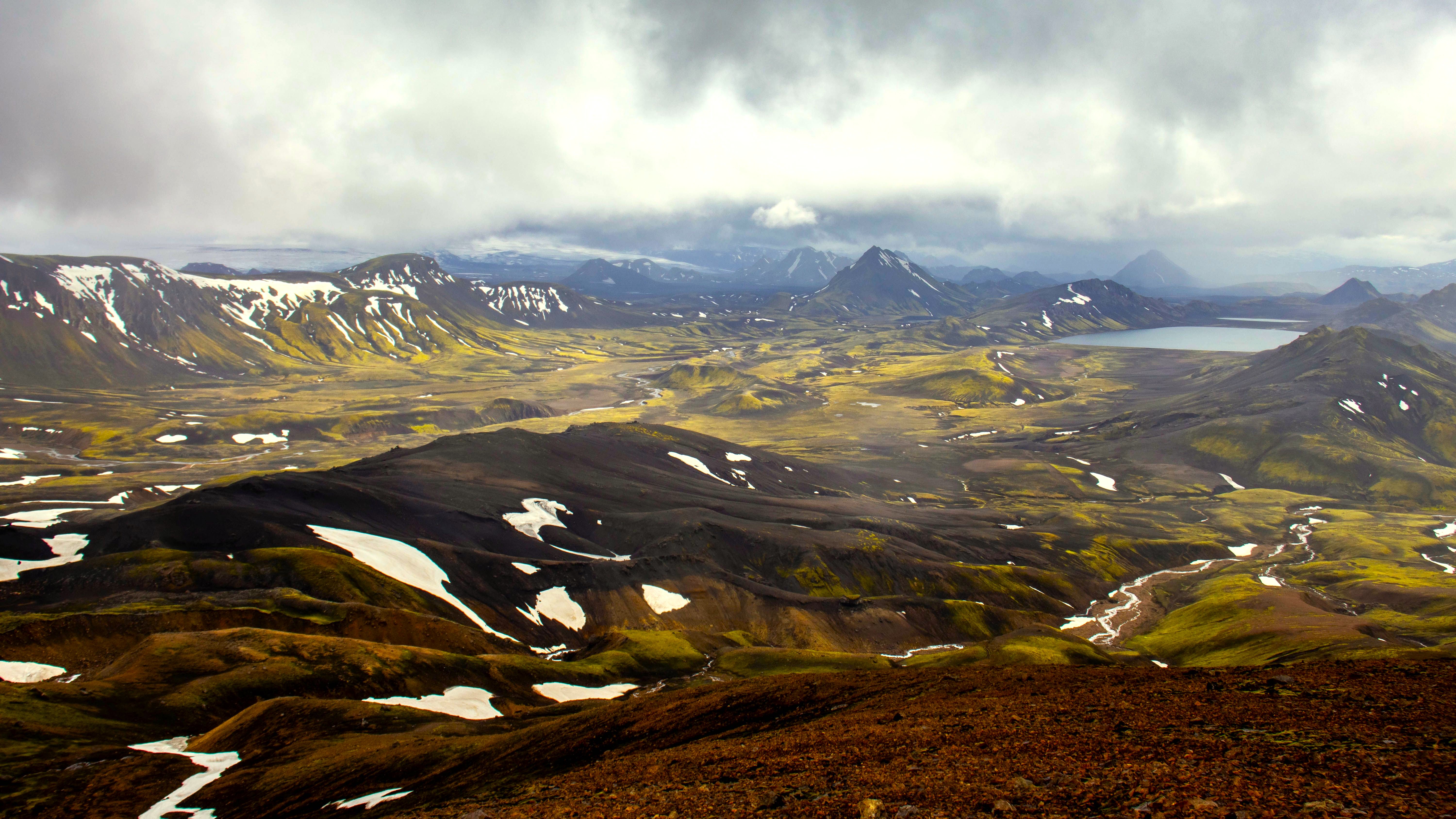
The landscape is dominated by black lapilli fields, solidified lava flows, and steep caldera walls. Lake Öskjuvatn, formed after the cataclysmic eruption of 1875, reaches depths exceeding 200 meters. A few hundred meters away, the small crater Víti — whose name means "hell" in Icelandic — contains geothermal water of an opaque blue-green hue, maintained at a pleasant temperature for bathing.
History and Context
The 1875 eruption was one of Iceland's most destructive in modern times: ash fallout devastated pastures in the eastern part of the country and triggered a wave of emigration to North America. The main caldera formed during this event. In 1961, astronauts Neil Armstrong and Buzz Aldrin trained here to simulate lunar conditions before the Apollo 11 mission — the black lava terrain and lack of vegetation made the analogy convincing.
Highlights of the Visit
Bathing in the Víti Crater
Descending the crumbly slope to the edge of the geothermal lake remains the most singular experience at the site. The water, slightly sulfurous, contrasts with the cold air of the Highlands. The descent requires caution: the compacted ash ground is unstable in places.
The Panorama over Öskjuvatn
From the caldera rim, your view plunges onto the dark expanse of the lake. In clear weather, cloud reflections on the water and the absolute silence of the lava desert create an atmosphere difficult to find elsewhere in Iceland.
Crossing the Lava Desert
The 4x4 journey along the F88 route through the volcanic sands of Ódáðahraun is an integral part of the experience. Several glacial river fords must be crossed — their levels vary depending on daily snowmelt.
Photography Tips
Low-angle light in the morning or late afternoon accentuates the textures of the black lava fields. The contrast between the milky green of Víti and the black crater walls is maximum under overcast skies, which eliminates stray reflections. Avoid midday in summer: high sun flattens the relief. No known photography restrictions apply at the site.
Location and Access
Askja is located in the central Highlands, approximately 200 km southeast of Akureyri and about 100 km south of Lake Mývatn. Access is exclusively via Route F88, which runs alongside the Jökulsá á Fjöllum river. A 4x4 with high ground clearance is mandatory — standard passenger vehicles are prohibited on F-category routes. Organized 4x4 bus excursions depart regularly from Mývatn during the summer season, which is the safest option for those without experience on Icelandic mountain roads.
Nearby Attractions
- Lake Mývatn — the main departure point for Askja, surrounded by pseudocraters, lava fields, and geothermal springs.
- Dettifoss — Europe's most powerful waterfall, accessible via Route 862 northeast of the area.
- Krafla — active volcanic zone near Mývatn, with the lava lake Víti (namesake) and the Leirhnjúkur fumaroles.
- Herðubreið — volcanic table mountain dubbed "the queen of Icelandic mountains," visible from the road leading to Askja.
Frequently asked questions
Route F88 typically opens in late June and closes in early October, depending on snow cover and ford conditions. Dates vary each year — check the status of roads on the official Icelandic Road Administration website (road.is) before departing.
Yes, bathing is permitted in the Víti crater. The geothermal water is warm. The descent to the lake is steep and slippery: hiking boots with aggressive tread are essential.
Yes, without exception. Route F88 includes several glacial river fords and sections of loose volcanic sand. Two-wheel-drive vehicles or those with low ground clearance are prohibited on F-category routes in Iceland. An alternative is to join an organized 4x4 bus excursion from Mývatn.
Plan a full day. The journey from Mývatn represents several hours of driving each way, plus the hike to the calderas and time on-site. Depart early in the morning.
No commercial services exist at Askja. A mountain refuge (Dreki) is located near the road, managed by the national park authorities, but advance booking is advised and you should bring all your provisions.
The site is volcanically active, but no major eruption has occurred since 1961. Primary risks are related to weather conditions (wind, sudden cold), glacial river fords, and unstable terrain around Víti. Always inform someone of your itinerary before venturing into the Highlands.
Interested in this visit?
We can include it in your personalised itinerary.