Þingvellir National Park (Thingvellir)
Þingvellir National Park (Thingvellir)
Þingvellir brings together in one site the visible boundary between two tectonic plates, the birthplace of the Icelandic parliament founded in 930, and Iceland's largest natural lake — just 40 km from Reykjavík.
Þingvellir is a tectonic plain approximately 40 km northeast of Reykjavík, inscribed on the UNESCO World Heritage List. Here, the Eurasian and North American plates visibly diverge, and Vikings founded the Althing, one of the world's oldest parliaments, in 930. Nature, geology, and Icelandic history converge in a single landscape.
Practical Information at a Glance
- Entrance: free park access; parking is paid (parking fees required at main car parks).
- Access: car rental recommended from Reykjavík (Route 36); included in most Golden Circle tours.
- Recommended duration: 2 to 4 hours for main trails; full day if diving or extended hiking.
- Attire: waterproof hiking boots, layered clothing — weather changes year-round.
- Accessibility: the main footbridge (Almannagjá) is partially accessible; uneven terrain on secondary trails.
- Diving/snorkeling: only with an authorized operator in the Silfra rift (advance booking essential).
What to See
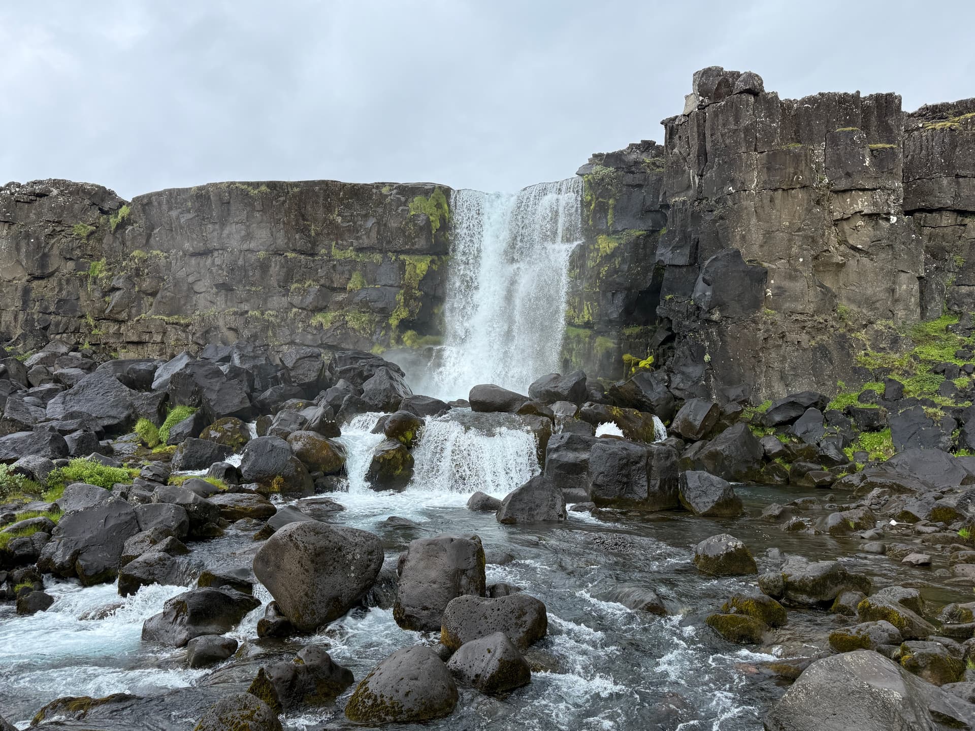
The Almannagjá rift cuts through the park from north to south: a basalt gorge where the Earth's crust has literally opened. Lake Þingvallavatn, Iceland's largest natural lake, fills the valley floor. The Silfra rift, fed by filtered waters from Langjökull Glacier, offers exceptional underwater visibility. The white church of Þingvallakirkja and the ruins of the Althing lodges complete the picture.
History and Context
The Althing convened for the first time on this site in 930. Clan leaders (goðar) gathered here each summer to legislate, dispense justice, and settle disputes. The "Law Rock" (Lögberg) was the focal point for public speeches. In the year 1000, the decision to adopt Christianity in Iceland was made here. The site was abandoned as the seat of parliament in 1798, then declared Iceland's first national park in 1928.
Highlights of Your Visit
The Almannagjá Rift
This black basalt corridor marks the visible boundary of the North American plate. A marked trail runs along the ridge and descends into the gorge. Low-angle light in morning or evening accentuates the rock textures.
The Silfra Rift
Diving or snorkeling between two tectonic plates is a rare geological experience. Water filtered for decades through lava reaches clarity of several tens of meters. The temperature remains around 2 °C year-round: a drysuit is mandatory.
Lake Þingvallavatn
Iceland's fourth-largest lake by area, it is home to endemic species of trout and Arctic char. The shores are accessible on foot from several park trails.
The Althing and Þingvallakirkja
The foundations of medieval lodges remain visible near the Öxará river. The present church dates from the 17th century; the adjacent cemetery holds important Icelandic historical figures.
Photography Tips
Golden light in late afternoon illuminates Almannagjá's walls without glare. In autumn, dwarf birches turn yellow and red — striking contrast with black basalt. For Silfra, a waterproof camera housing is essential; natural light suffices on the surface but diminishes rapidly with depth. Northern lights are visible above the lake in winter under clear skies, far from Reykjavík's light pollution.
Location and Access
Þingvellir is located approximately 40 km northeast of Reykjavík via Route 36. It's the classic first stop on the Golden Circle. Several car parks dot the park (P1 near the visitor center, P5 for Silfra). No regular public transport from Reykjavík; organized excursions from the capital are abundant. The visitor center offers maps and trail information.
Nearby Attractions
- Geysir — The Strokkur geyser erupts every few minutes; approximately 60 km east via Route 35.
- Gullfoss — Stepped double waterfall in the Hvítá canyon, about thirty kilometers from Geysir.
- Laugarvatn — Thermal village on the shore of its namesake lake, between Þingvellir and Geysir.
- Reykjavík — Iceland's capital, the natural logistics hub for visiting the Golden Circle.
Frequently asked questions
The park is open year-round. Summer (June–August) offers long days and clear trails. Autumn (September–October) brings the colors of dwarf birches. In winter, snow and northern lights transform the landscape, though some trails may be icy.
Yes. Diving and snorkeling at Silfra are available only through operators authorized by the park. Slots are limited; book several weeks ahead during peak season.
Yes, this is the classic Golden Circle route. Plan a full day from Reykjavík, starting at Þingvellir in the morning to avoid crowds.
Trail access is free. However, main car parks charge a fee. Bring a credit card; parking machines typically do not accept cash.
The main Almannagjá footbridge is partially wheelchair accessible. Secondary trails and lakeside areas feature uneven terrain unsuitable for wheelchairs.
Yes. The absence of light pollution and open horizon above the lake make it a good viewing spot between September and March on clear nights with sufficient solar activity.
Interested in this visit?
We can include it in your personalised itinerary.