Fjallabak Nature Reserve
Volcanoes, multicolored rhyolites and natural hot springs: the Fjallabak reserve in Iceland's Highlands concentrates some of the country's most spectacular landscapes, accessible by 4×4 from June to September.
Fjallabak Nature Reserve extends into the heart of Iceland's Highlands, between Hella and Kirkjubæjarklaustur. This volcanic territory of roughly 470 km² brings together rhyolites in ochre and pink hues, geothermal lakes, recent lava flows and glaciers. It's one of the rare protected areas in the Highlands accessible without an extreme expedition, notably via the F208 track (Fjallabaksleid Nyrðri).
Essential practical information
- Access: F208 track (4×4 mandatory, river crossings required). Closed in winter, generally open from mid-June to September depending on conditions.
- Admission: free access to the reserve; some interior campsites are fee-based.
- Recommended duration: 1 to 3 days to explore the main sites.
- Clothing: waterproof hiking gear essential; temperatures remain low even in summer.
- Rules: camping only in designated zones; fires prohibited outside designated facilities.
What to see
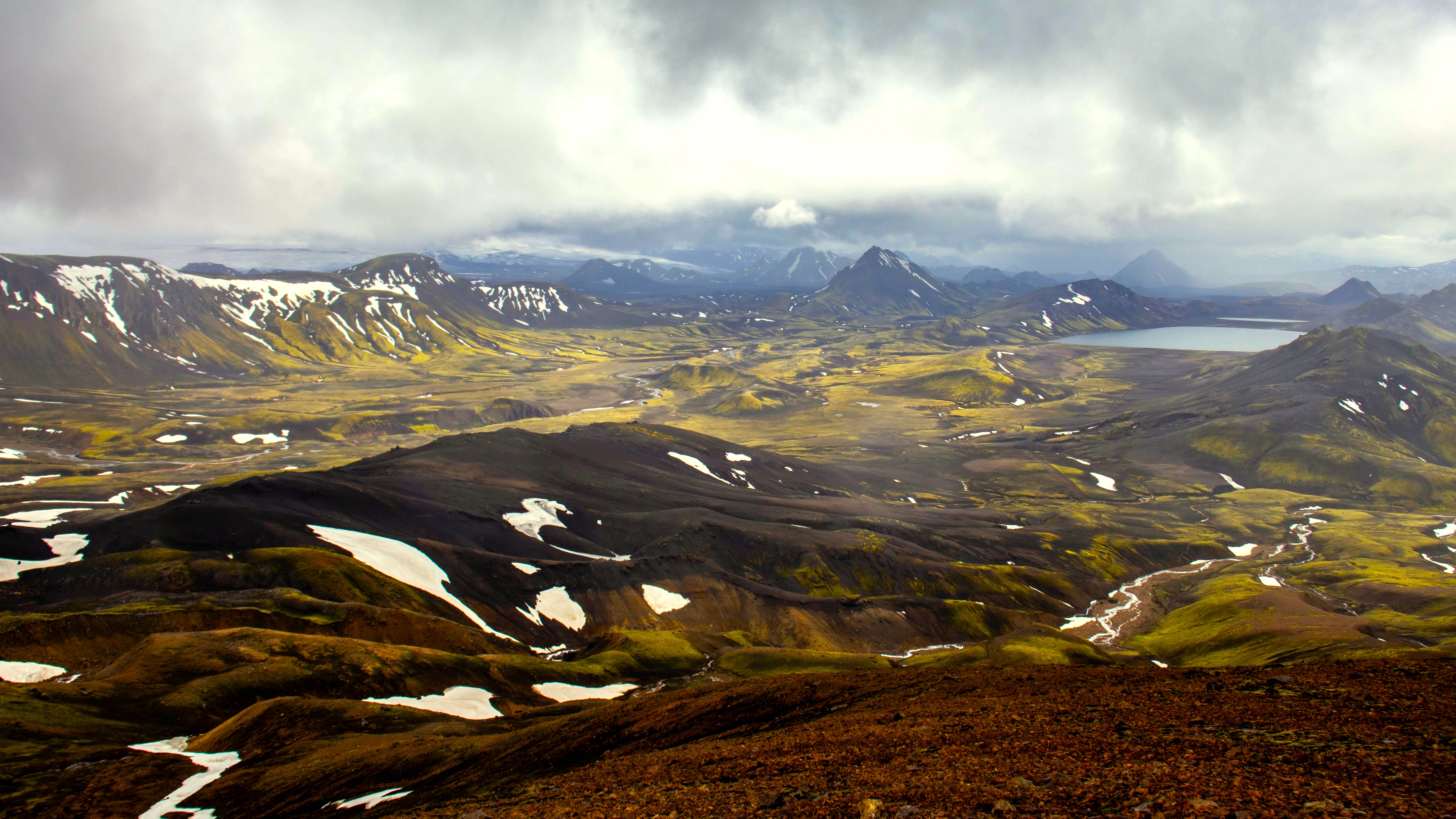
The landscape alternates between black lava fields, colorful rhyolite mountains and valleys crossed by glacial rivers. Lake Frostastaðavatn and Lake Ljótipollur — a crater filled with blood-red water — rank among the most photographed bodies of water. The Torfajökull geothermal zone, Iceland's largest active volcanic system by area, borders the reserve to the north.
History and context
Fjallabak literally means "behind the mountains" in Icelandic. The reserve was established in 1979 to protect this exceptional volcanic landscape. The F208 track was historically one of the interior routes used by farmers to traverse the Highlands before the construction of coastal roads.
Highlights of your visit
Lake Ljótipollur
This volcanic crater filled with water displays a striking burgundy-red color due to ferrous minerals. A short path from the F208 track allows you to reach the crater's rim and make a partial circuit around it.
The rhyolite mountains of Landmannalaugar
At the reserve's northern entrance, Landmannalaugar is the starting point for the Laugavegur trek. The rhyolite-clad slopes — sulfur yellow, green, pink, gray — contrast sharply with the black lava flows of Laugahraun, dating from the 15th century.
The hot springs of Landmannalaugar
A natural geothermal spring mingles with a cold stream at the foot of the mountains, creating a basin at a pleasant temperature. Swimming is free and heavily frequented in summer.
The Laugavegur trek
This multi-day trail connects Landmannalaugar to Þórsmörk. It traverses landscapes of ash deserts, glaciers and verdant valleys. Considered one of the great Nordic treks, it requires advance refuge reservations.
Photography tips
Low-angle light in the morning and evening (often after 8 p.m. in summer) accentuates the relief and colors of the rhyolites. Lake Ljótipollur photographs best from the crater's rim in late afternoon. The black lava flows of Laugahraun offer strong contrast against the colored mountains in the background.
Location and access
Fjallabak lies in the Highlands, approximately 200 km east of Reykjavik. The main access is via the F208 track from Route 26 to the north, or from Route 208 to the south. A 4×4 vehicle with high ground clearance is imperative: river crossings can be deep and conditions change rapidly. Highlands buses connect Reykjavik to Landmannalaugar in summer — a viable option without a personal 4×4. Accessibility for people with reduced mobility is very limited outside the Landmannalaugar campsite.
Nearby attractions
- Landmannalaugar — northern gateway to the reserve, hot springs and Laugavegur trailhead.
- Þórsmörk — wooded valley at the foot of glaciers, southern terminus of the Laugavegur trek.
- Hekla Volcano — one of Iceland's most active volcanoes, visible from the reserve's northern edges.
- Eldgjá — volcanic canyon to the southeast, one of the largest fissure eruptions in human history.
Frequently asked questions
The F208 track is generally passable from mid-June to September. Outside this period, interior roads are closed or dangerous. July and August offer the best weather conditions and longest daylight hours.
Yes, to drive on the F208. River crossings are mandatory and can be deep. If you don't have a 4×4, seasonal mountain buses allow you to reach Landmannalaugar from Reykjavik.
Wild camping is prohibited; you must use designated camping zones. The Landmannalaugar campsite is the most popular and has basic facilities. Advance reservations are recommended during peak season.
Yes, it begins at Landmannalaugar, at the reserve's northern entrance, and ends at Þórsmörk. It's typically completed in 4 days with nights in refuges, which book well in advance.
Access to the natural spring is free. It's a natural basin with no hotel infrastructure; bring a swimsuit and towel.
Interested in this visit?
We can include it in your personalised itinerary.