The Geography of Iceland
Part of the European continent, Iceland sits at the gateway to the Arctic Circle in the North Atlantic Ocean, between the Faroe Islands and Greenland, southeast of the Denmark Strait and northeast of the United Kingdom.
Where Iceland Is Located
Part of the European continent, Iceland sits at the gateway to the Arctic Circle in the North Atlantic Ocean, between the Faroe Islands and Greenland, southeast of the Denmark Strait and northeast of the United Kingdom. It is the world's 19th largest island, and the second largest in Europe after Great Britain.
Having emerged approximately 15 million years ago, the island continues to evolve today through volcanic activity. More than forty smaller islands are part of Iceland's territory, including the Westman Islands archipelago.
Iceland's Geography by the Numbers
Iceland extends 500 km in width and 300 km in length. The country covers a total area of 103,000 km², composed largely of sandy expanses, volcanic terrain, pastureland, and glaciers. Cultivated land covers barely 1% of the territory. Trees are equally scarce. Apart from the Forests of Iceland along the banks of Lake Lagarfljót, they are concentrated in the protected valleys.
The island has an average elevation of 557 m. Hvannadalshnúkur is its highest point (2,110 m), located on the country's largest glacier and Europe's most expansive ice cap, Vatnajökull (8,100 km²).
The Icelandic Landscape
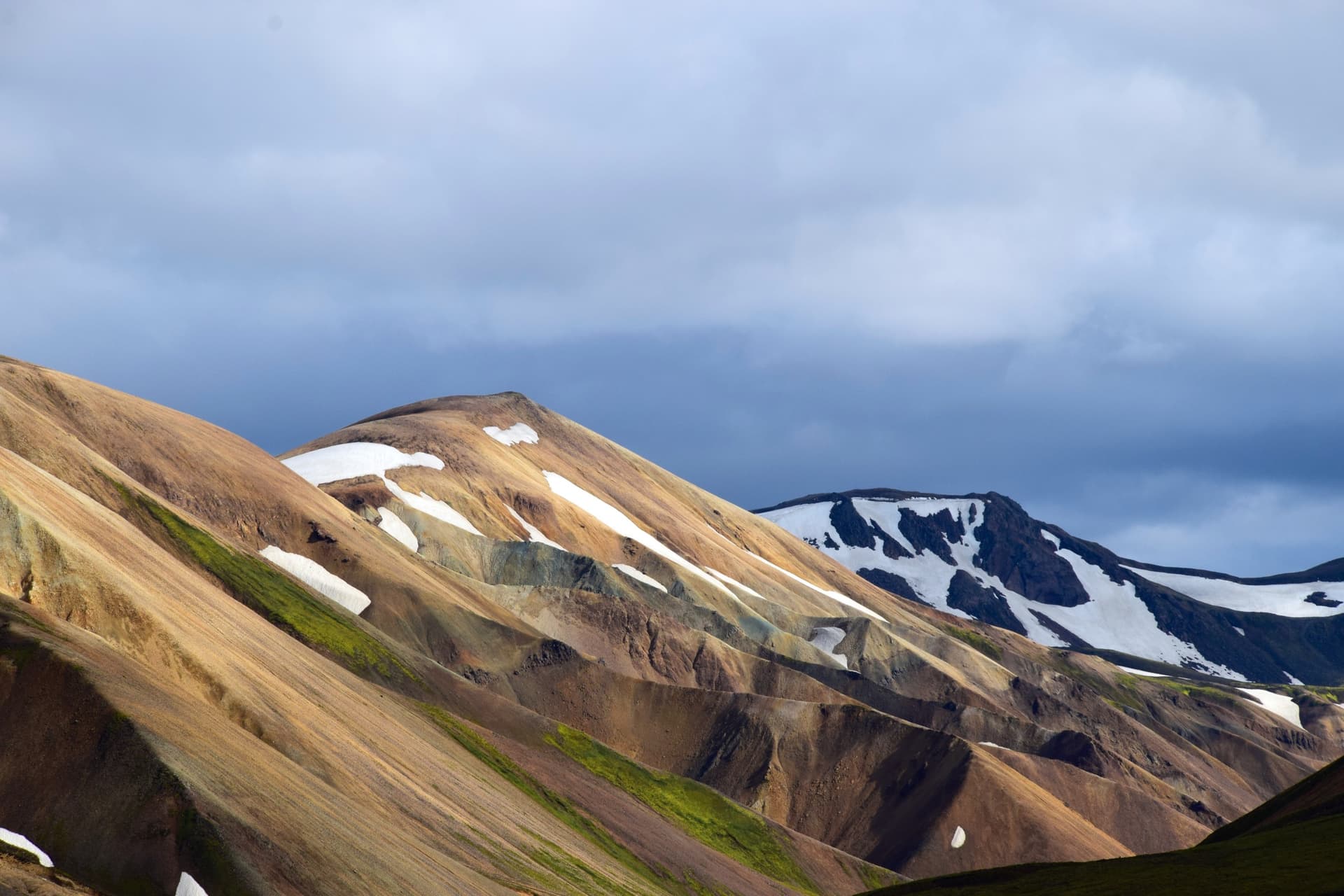
Between vast pastureland and ash deserts, towering volcanoes and majestic glaciers, snow-capped mountains and multicolored hills, not to mention the famous fjords and impressive gorges, Iceland presents captivating landscapes of striking contrasts.
Land of Fire
Iceland possesses a distinctive volcanic temperament due to its position straddling the American and Eurasian tectonic plates. Intense activity since ancient times has shaped immense lava fields across the island, thermal springs, colorful rock formations, and solfataras. The word "geyser" was born in Iceland. 130 volcanoes remain active, including Krafla and Askja, which are under permanent surveillance, as is the formidable subglacial volcano Katla.
Land of Ice
The country, whose name means "land of ice," is home to Europe's largest glacier, Vatnajökull, which spans 8,300 km² in area. Smaller in scale, the Snæfellsjökull glacier (11 km²) is nonetheless the most famous thanks to Jules Verne's novel "Journey to the Center of the Earth." Numerous bodies of water, lakes, and waterfalls are fed by glacial melt. In the northwestern part of the island, glaciers have carved several steep fjords that stand as true treasures of nature.
The Highlands
Another strikingly distinct contrast, the Icelandic Highlands appear as untamed wilderness, completely different from the coastal regions where the country's main cities and villages are found. Few people live in Iceland's high plateaus, where desert landscapes possess a lunar, even Martian quality. That said, it is in these remote reaches that some of the country's most stunning attractions are nestled, such as Landmannalaugar or Askja volcano. Between the Highlands and the coast, spectacular waterfalls like Dynjandi and Skogafoss enhance the landscape.
Fauna and Flora
Although limited in diversity, Iceland's fauna and flora encompass distinctive species. Birds constitute the primary draw on the wildlife side. Regarding vegetation, mosses, grasses, and lichens predominate. Trees are sparse. Reforestation programs are underway, however, to reverse this trend.
Iceland's Principal Cities
Iceland has a total of 76 municipalities, the largest being the capital Reykjavik and the smallest Árneshreppur. The majority of the population resides in the Höfuðborgarsvæðið metropolitan area, composed of Reykjavik, Hafnarfjörður, Garðabær, and Mosfellsbær.
Among other notable cities, you'll find:
- Akureyri in the country's north, at the gateway to Eyjafjörður fjord
- Reykjanesbær, 46 km from Reykjavik in the island's southwest
- Árborg inland, about a hundred kilometers from the capital
- Akranes on the western coast
- Fjarðabyggð on Reyðarfjörður fjord in the country's east
- Vestmannaeyjar on Westman Island in southwestern Iceland
- Grímseyjarhreppur on Grímsey Island
Iceland and Its Natural Resources
Iceland's natural resources are limited, the island lacking oil and gas reserves. Metallic minerals are equally scarce. Conversely, sulfur and basalt are abundantly present. Thanks to its distinctive geology and climate, Iceland is able to generate nearly all of its electricity using renewable energy resources such as hydroelectric, geothermal, and wind power.
Although cultivated land represents only 1% of the territory, the country produces tomatoes, cucumbers, bananas, and more by harnessing geothermal energy to heat greenhouses, as in Hveragerði. On the livestock front, sheep, horses, and cattle lead the way. Finally, and importantly, fishing constitutes the primary livelihood of one in five Icelanders and makes up 90% of the country's exports.